A timber inventory is one of the most important services provided by a consulting forester. A thorough timber inventory allows for a better understanding of forest management strategies that may be successfully implemented on your property. An inventory is also the first step towards enrolling into New York’s 480a Forest Tax Law Program.
Merriam-Webster defines an inventory as “an itemized list of current assets: such as a list of goods on hand, a catalog of the property of an individual or estate, or a survey of natural resources”. An inventory is a process used by foresters to help a landowner get an understanding of the “goods” that their property holds. This is the first step required to enter your property into New York State’s 480a Forest Tax Law Program. A thorough inventory allows foresters to make data driven management decisions on your forest that align with your objectives, while maximizing the growth of trees. While there are countless site characteristics of a forest that may be inventoried, foresters are primarily looking at and measuring the following
- overstory/understory trees
- shrubs and ground cover
- invasive species present
- special management zones (such as water bodies or presence of endangered species).
Every forester may have their own unique way to conduct their inventories, but every timber inventory takes similar measurements.
The Goal
The goal of an inventory is for a forester to be able to determine if your forest needs management, or if it is growing strong and healthy. The forester can take the data from their inventory and determine on a “stand level” if your forest is understocked, overstocked, or “just right”. If your stand is overstocked, a harvest or thinning may be in order. If your stand is understocked, the trees need more time to grow. If your forest is in the “just right” stocking level, a harvest may be coming soon! Along with understanding the stocking, the forester will be able to have a rough idea of the value of the timber on each stand. Foresters do not measure every tree in a forest during an inventory, so this is just a statistical estimate. With the data collected from the timber inventory, the forester will now be able to write a management plan or determine how much timber can be appropriately and responsibly harvested.
The Process
1. Planning and Goals
Forestry work involves a lot of planning and communication. The forester should have a conversation with the landowner to understand the goals and objectives they have for the property before they start the inventory. A forester should make management decisions differently based on the specific goals and objectives of each landowner.
2. Mapping
After communicating with the landowner, the forester goes to the computer to make a map with “plot points” on it. These plot points are the locations in the woods that the inventory takes place. There’s typically 1 plot for every 1-15 acres (more plots takes longer but is more accurate). A high-quality map of your forest and stand boundaries that qualify for the 480a Forest Tax Law Program is made at this stage.
3. Into the Woods
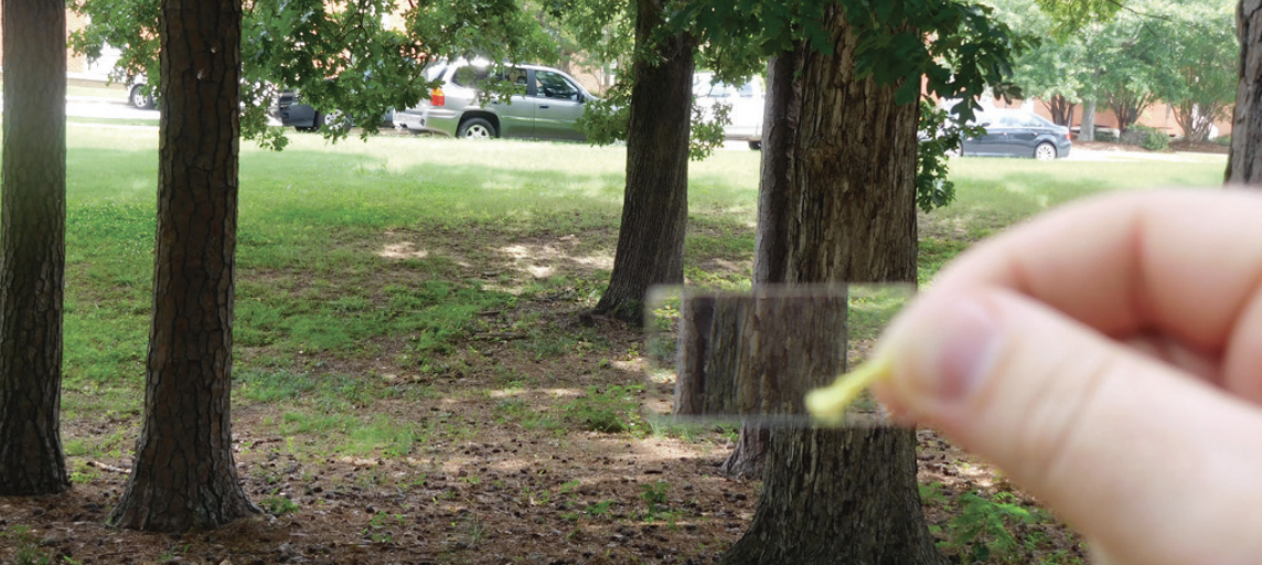
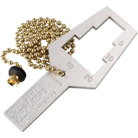
Once the map is prepared, the forester will head into the woods to start collecting data at the “plot center” points. Once arriving at plot center, most commonly an angle gauge or prism is used. This is a calibrated tool that tells the forester which trees to measure for a plot with a “Basal Area Factor” of 10.
- Basal area is the cross-sectional surface area of tree trunks measured at 4.5 feet above the ground.
This seems complicated, but angle gauges and prisms make this extremely easy! If the calibrated tools count 5 trees in the plot, the basal area is 50. If the tools count 10 trees as “in”, the basal area is 100. Each tree counts as 10 basal area. The units for this measurement are square feet per acre. When using a prism, if the trunk of the tree seen through the prism overlaps with the trunk seen without the prism, the tree is “in” and measured. If there is a gap between the viewed trunks, the tree is not measured and deemed to be “out”. The measurements of basal area and trees per acre are used to determine if the forest is properly “stocked”. When using an angle gauge, if the trunk is wider than the window of the tool it is “in”
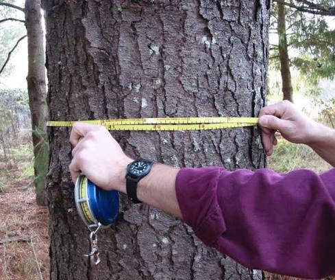
Once it is known which trees are “in” with the angle gauge or prism, it is now time to measure and identify those trees! A forester will then use their logger’s tape to measure the tree’s diameter. This is a tape measure that has already done the conversion from circumference to diameter, so no extra math is needed here! Then they will use a rangefinder or clinometer to measure the heights of the trees.
The forester will also take notes of observations they see in the understory, as well as what they see on their walk between plots.
Back to the Office
Now that all the field data is collected, the forester can process that data, combining all the data to develop statistics for each stand. They will now know the density, abundance, average sizes of the different species that they found on your property. These statistics will then allow them to understand what management practices can be implemented to help your forest according to the data available.
If you are entering into New York State’s 480a Forest Tax Law Program, this is the point that the forester would begin writing up the Forest Management Plan. They must enter the plot data from their inventory and construct a schedule of management to be approved for the program. Once the State finds these materials meet their specifications, you as the landowner will begin to realize the tax savings.