Do you know where NYC’s drinking water comes from?
Have you ever driven by one of the reservoirs in the New York City Watershed? Maybe the Ashokan Reservoir in the Catskills or the New Croton Reservoir in Westchester?
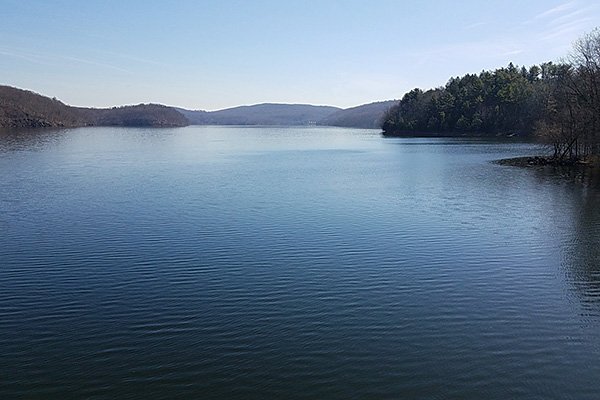
View of the New Croton Reservoir in Westchester, NY
In either case, it’s pretty obvious when you’re gazing out over the vast forest-lined waters that you’re NOT in New York City, so what’s with the name?
The “New York City Watershed” refers to the area of land that drains its water into the reservoirs that supply the city with its drinking water. NYC doesn’t get its water locally because the water surrounding the city is brackish (a mixture of salt and fresh water) and too polluted to drink.

Map of the New York City Watershed, which is the source of the city’s drinking water.
As you can see in the map above, the NYC Watershed is split between two regions – the Catskill/Delaware Watershed west of the Hudson River and the Croton Watershed east of the Hudson River. All told, the NYC Watershed is an area of over 2,000 square miles that drains its rainwater and snowmelt into 19 reservoirs and 3 controlled lakes. These water bodies provide over 1 billion gallons of clean drinking water to more than 9 million New Yorkers every day – that’s over half the population of New York State!
But wait, we know that every place on land is part of a watershed, so isn’t New York City itself part of a watershed and shouldn’t that be called the New York City Watershed? In fact, watersheds are named after the water body that the water drains into – like the Hudson River watershed or the Lake George watershed. When we talk about the “New York City Watershed,” we’re talking about the land that collects the water that eventually goes to New York City faucets. The 5 boroughs of the city are also in watersheds, namely the Hudson River watershed, East River watershed, Long Island Sound watershed and Atlantic watershed.
So how does all this water get from the Catskills down to the city? Well, the answer is pipes and the key word is down. HUGE underground pipes called aqueducts transport water as far as 125 miles from the Catskill Mountains down to the city at sea level. This natural change in elevation means the aqueducts are slanted downward and the water flows by gravity alone – no pumping required!

Students from New York City stand by the Ashokan Reservoir and form a 15-ft diameter circle, which is the average diameter of the aqueducts that deliver fresh water from NYC Watershed reservoirs to city consumers.
The reservoirs were created by damming rivers and flooding the river valleys behind them. Before the reservoirs were built, dozens of towns and thousands of residents were nestled in these valleys. Many of the families had worked the land for generations. From the mid-1800s to the late 1900s, New York City took people’s land by eminent domain to secure safe, clean drinking water for millions of downstate consumers. The city paid people for their land but many argued that they were not fairly compensated.
Today, most of the NYC Watershed is owned by private families and individuals – like you! These folks help care for the land that supplies so many New Yorkers with clean water. Stay tuned for an upcoming blog that will explore how water quality is protected on working farm and forestland in the watershed.


